Identify and Protect Critical Visual Resources
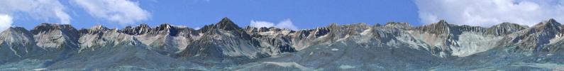
Ridgelines - Hillsides - Spectacular Views
Scenic resources draw visitors to communities and enhance the quality of life for residents. Particularly in rural areas, there's a strong connection between natural setting and economic vitality. The problem that communities face is determining how to identify and protect their visual resources while respecting private property rights and accomodating reasonable development. Landowners and developers are much more likely to support visual impact regulations if they perceive them as fair, objective and providing a high degree of certainty in the development review process.
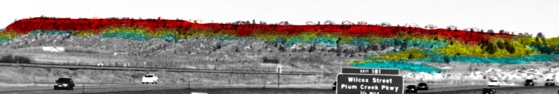
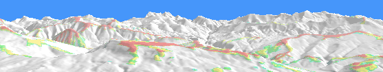
We've worked with numerous communities, focusing on defensible, well-defined approaches to meet their visual resource protection objectives. Toward this end, we've developed software and methodologies geared specifically toward ridgeline protection, critical viewsheds delineation and views to distinctive landforms. Our projects section describes work we've done with communities to help preserve their scenic setting, including the Smart Growth award-winning "Douglas County Environmental and Visual Analysis."
For other examples of visual resource identification and protection, visit our mapping visual resources portfolio.
Visual Resource Identification Toolkit
In our work with communities across the U.S., we've refined a package of services and software tools that have proven to be especially helpful.
- Visual resource mapping
- Visibility census
- Sight-line evaluation
- Development Visualization